Author: DiveSpots
-
Rodeo Divers Artificial Reef
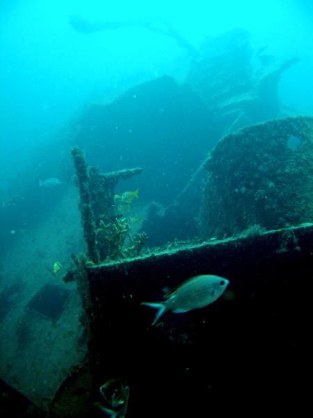
Fast Facts: Features: Need Gear? Download all Fort Lauderdale GPS Coordinates This artificial reef is located 1.5 miles due east of Pompano Pier. This site is a collection of at least eight wrecks which have come together to assist in the formation of the reef. Two 32-foot tug boats known as the Qualmann Tugs rest…
-
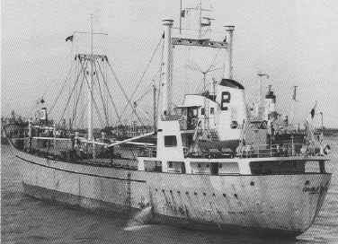
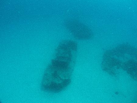
Rodeo 25
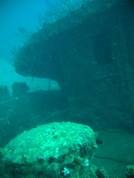
Fast Facts: Features: Need Gear? Download all Fort Lauderdale GPS Coordinates This site gets its name from the sinking of the Windward Trader in May 1990 in celebration of the 25th anniversary of the Pompano Beach Rodeo. This 215-foot twin-masted Dutch Freighter lies 1.5 miles due east of the Pompano Pier in 122 feet of…
-
Rebel
Fast Facts: Features: Need Gear? Download all Fort Lauderdale GPS Coordinates This Dutch freighter was built in 1947 and named Cornelis. Her name changed several times beginning with when she was sold in 1981 and renamed Island Transported. She was later named St. Andrea but was confiscated for drug smuggling. At a federal auction, she…
-
Oakland Ridge Moorings
Fast Facts: Features: Need Gear? Download all Fort Lauderdale GPS Coordinates About three miles north of the Port Everglades Inlet lay the Oakland Ridge moorings. This series of 15 mooring is a marker for a ledge located 18 to 28 feet down. Several caves and crevices provide homes to glassy sweepers and snook. This is…
-
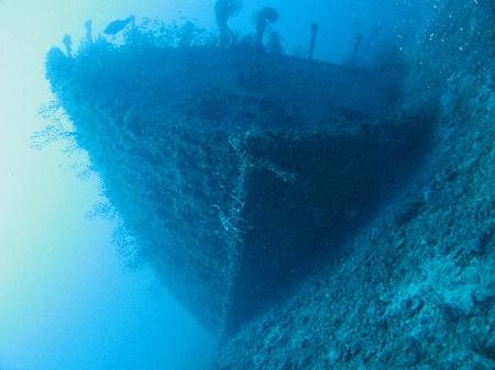
Mercedes I
Fast Facts: Features: Need Gear? Download all Fort Lauderdale GPS Coordinates The most famous of Fort Lauderdale’s wrecks is the 198-foot freighter Mercedes I. She received national attention, when on Thanksgiving Day in 1984 during a terrible storm, she lost her anchorage and ran aground against the seawall of an exclusive Palm Beach seaside mansion.…
-

Mary St. Phillips
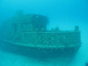
Fast Facts: Features: Need Gear? Download all Fort Lauderdale GPS Coordinates This 110-foot steel tug, along with another 130-foot barge, was sunk in 1993 to form an artificial reef. Mary St. Phillips, also known as Mariner II tug, was built in 1943 and used to tow petroleum barges. The sunken barge was initially used for…
-
Jim Atria Artificial Reef
Fast Facts: Features: Need Gear? Download all Fort Lauderdale GPS Coordinates Jim Atria was a developer, diver, and sport fisherman who lived in Broward County. He assisted in the sinking of this vessel because he wanted to show his appreciation for the surrounding community. The ship, a 240-foot Dutch freighter, was originally named Poinciana and…
-
Jay Scutti Tug Artifical Reef Site
Fast Facts: Features: Need Gear? Download all Fort Lauderdale GPS Coordinates At the center of this artificial reef is the Jay Scutti, a harbor tugboat purchased by Dale Scutti and donated to the Broward County’s Artificial Reef Program in order to be sunk in memory of his son, Jay. This site is now a collection…
-
Houseboat
Fast Facts: Features: Need Gear? Download all Fort Lauderdale GPS Coordinates Originally named Duzaway, this 70-foot wreck known as Old Houseboat, was reefed in 90 feet of water in 1987 to create and artifical reef. Soft coral and baitfish inhabit this wreck, which is impressive for its colorful nature. There are many schools of large…
-
Hog Heaven
Fast Facts: Features: Need Gear? Download all Fort Lauderdale GPS Coordinates Hog Heaven is a 180-foot barge that lies upside down in 64 feet of water. While traveling to be sunk as an artificial reef, this ship flipped upside down. The barge was owned by Western Contractors Company of Iowa and was sunk in 1986.…