Author: DiveSpots
-
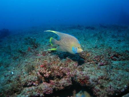
Normannia
Fast Facts: Features: Need Gear? Download all Wilmington GPS Coordinates The Danish freighter, Normannia, served less than thirty years before meeting its demise on the Frying Pan Shoals forty miles offshore of southern North Carolina. On the night of January 16, 1924, the Normannia encountered a fierce southeastern gale. She began to take on water…
-
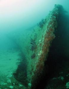
Markham
Fast Facts: Features: Need Gear? Download all Wilmington GPS Coordinates The Markham is a US Army Corps of Engineers dredge that was sunk in the Artificial Reef area AR-386 close to the Hyde dredge. The dredge is 320 feet in length and lies inverted on its port side. The starboard prop, strut and rudder are…
-
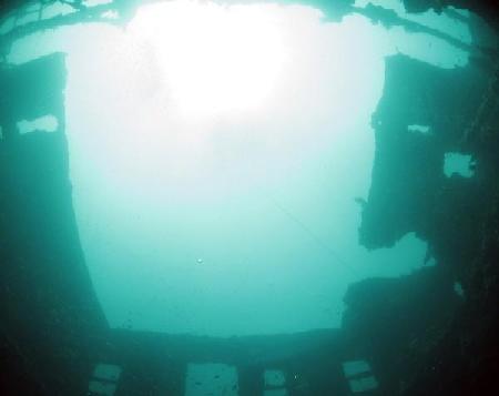
Hyde
Fast Facts: Features: Need Gear? Download all Wilmington GPS Coordinates The Hyde served as a dredge with the US Army Corps of Engineers in the Gulf of Tonkin during the Vietnam War. In May of 1988, the 215-foot Hyde was deployed by the NC Department of Marine Fisheries in AR-386 located about 15 miles off…
-

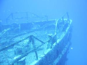
W.E. Hutton
Fast Facts: Features: Need Gear? Download all Crystal Coast / Morehead City GPS Coordinates March of 1942 was a dangerous month for ships along the NC coast. German U-boats sank the greatest number of U.S. ships that month. The W. E. Hutton was a tanker transporting fuel oil from Texas to Pennsylvania. The ship stayed…
-
Suloide
Fast Facts: Features: Need Gear? Download all Crystal Coast / Morehead City GPS Coordinates The freighter, Suloide, rests about a mile from the W.E. Hutton. On March 26, 1943, as the Suloide steamed past the NC coast with a full load of manganese ore, she ran aground on the wreckage of the tanker, the W.E.…
-
Spar, U.S.C.G.
Fast Facts: Features: Need Gear? Download all Crystal Coast / Morehead City GPS Coordinates The Spar was a working ship and served from Portsmouth, NH, to northeastern Maine maintaining navigational aids, supporting seven lighthouses and performing ice-breaking operations. Spar was decommissioned in 1997 and transferred to the Northeastern Maritime Historical Foundation. The ship was stripped…
-

Papoose
Fast Facts: Features: Need Gear? Download all Crystal Coast / Morehead City GPS Coordinates The Papoose was launched in 1927 by the Petroleum Navigation Company. The tanker transported gasoline between Texas and New York until pressed into military service during World War II. On the night of March 18, 1942, the Papoose was returning to…
-
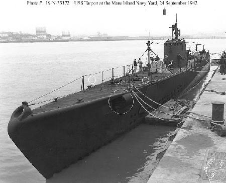
Tarpon
Fast Facts: Features: Need Gear? Download all Cape Hatteras GPS Coordinates The U.S.S. Tarpon is an American submarine that served in the Pacific during World War II. She sank off Cape Hatteras in 1957 and now rests in 140 feet of water. Waypoint: EMPGEM Latitude Longitude Degrees 34.753250 -75.767083 Degrees/Minutes/Seconds N 34 45 11.7 W…
-
Proteus
Fast Facts: Features: Need Gear? Download all Cape Hatteras GPS Coordinates In August 1918, the Proteus collided with a tanker off Cape Hatteras and now rests in 125 feet of water about 25 miles south of the Hatteras Inlet. Waypoint: EMPGEM Latitude Longitude Degrees 34.765300 -75.783500 Degrees/Minutes/Seconds N 34 45 55.1 W 75 47 0.6
-
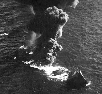
Empire Gem
Fast Facts: Features: Need Gear? Download all Cape Hatteras GPS Coordinates The British tanker, Empire Gem, was en route from Texas to the United Kingdom with a full cargo of more than 10,000 gallons of gasoline when she was sunk in 1942 by a German U-boat. The Gem was approximately 15 miles southeast of the…