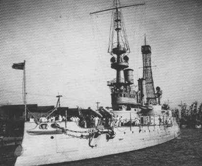
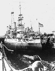
Among the largest and most advanced ships of her time, the Massachusetts was a heavy-caliber battleship and one of the first to be assigned a hull number by the US Navy. Officially commissioned on June 10, 1896, The Massachusetts was over 350-feet long, with a beam of 69-feet and a displacement of over 10,000 tons. In a world still dominated by wooden ships, the massive steam-powered Massachusetts was nothing short of awesome. She was equipped with an impressive array of firepower, including 13-inch gun batteries, 8-inch secondary batteries, two Colt Gatling guns, three torpedo tubes and a number of smaller weapons.
The Massachusetts saw her first battle duty during the Spanish-American War, where she sailed to Cuba to help blockade the ports of Cienfuegos and Santiago. In the following years, the Massachusetts performed a variety of duties, conducting military exercises in several different ports. Despite her impressive technology and size, the vessel had several flaws in her design. One of the most serious was her low freeboard, which made the guns difficult to operate in heavy seas.
By the start of World War I, she was relegated to light duty as a training vessel and later decommissioned in 1919. In 1921, she was towed to Pensacola, scuttled in shallow water and used as a target for coastal artillery batteries.
The site was dedicated as an underwater archaeological preserve on June 10, 1993, on the 100th anniversary of the ship’s launching.
Today, the USS Massachusetts sits in 30 feet of water with portions of the hull still exposed. Despite the battering of more than 100 artillery rounds, the hull remains remarkably intact. This beautiful dive is awash in emerald-green water, partially buried on a white sandy bottom.
Despite her shallow depth, the Massachusetts can be an unpredictable and often difficult dive because of her close proximity to Pensacola Pass. This area is subject to strong currents and poor visibility. Plan your dives closely around the tides.


| Waypoint: USSMAS | Latitude | Longitude |
|---|---|---|
| Degrees | 30.2966666666667 | -87.3121666666667 |
| Degrees/Minutes | N 30 17.800 | W 87 18.730 |
| Degrees/Minutes/Seconds | N 30 17 48.000 | W 87 18 43.800 |


Leave a Reply