Category: Destin
-

Thomas Hayward (Liberty Ship)
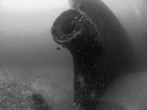
Fast Facts: Features: Need Gear? Download all Destin GPS Coordinates Designed to serve as an emergency cargo ship for the U.S. Maritime Commission, the 360 foot Liberty Ship, Thomas Hayward, was built by the Alabama Drydock Company in 1942. On May 5, 1946, the ship hit a floating mine off Europe. Despite the damage, the…
-

The Tanks
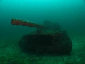
Fast Facts: Features: Need Gear? Download all Destin GPS Coordinates As part of the Okaloosa County Artificial Reef Program, fourteen United States Armored M-60 tanks were placed underwater in December 1994. The tanks were sunk in three sets at depths ranging from 65-70 feet. The tanks are all intact, making this divespot a great site…
-

Mohawk Chief / Sand Dollar Artificial Reef
Fast Facts: Features: Need Gear? Download all Destin GPS Coordinates Okaloosa County and the cities of Destin and Valparaiso teamed up to create a Sand Dollar Artificial Reef Complex in 2003. The complex is a set of six patch reefs arranged about 800 feet apart in a hexagonal shape around a center point. The center…
-

Miss Louise
Fast Facts: Features: Need Gear? Download all Destin GPS Coordinates The Miss Louise is a 95-foot tugboat that was sunk in 1997 as part of the Artificial Reef Program. She lies sin 55-60 feet of water with a 15-foot profile. Sea urchins cover the sides of the tug, crabs have made homes on the bottom…
-

Destin Bridge Rubble
Fast Facts: Features: Need Gear? Download all Destin GPS Coordinates Among the first projects of the Okaloosa County Artificial Reef Program was the deposit of concrete rubble from the Old Destin Bay Bridge. The rubble was sunk in the mid-1970s about one and one-half miles southeast of East Pass in depths ranging from 60-70 feet.…
