Category: Cape Hatteras
-
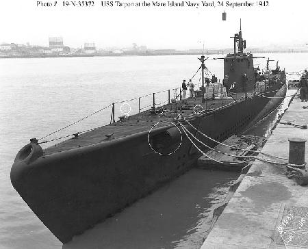
Tarpon
Fast Facts: Features: Need Gear? Download all Cape Hatteras GPS Coordinates The U.S.S. Tarpon is an American submarine that served in the Pacific during World War II. She sank off Cape Hatteras in 1957 and now rests in 140 feet of water. Waypoint: EMPGEM Latitude Longitude Degrees 34.753250 -75.767083 Degrees/Minutes/Seconds N 34 45 11.7 W…
-

Proteus
Fast Facts: Features: Need Gear? Download all Cape Hatteras GPS Coordinates In August 1918, the Proteus collided with a tanker off Cape Hatteras and now rests in 125 feet of water about 25 miles south of the Hatteras Inlet. Waypoint: EMPGEM Latitude Longitude Degrees 34.765300 -75.783500 Degrees/Minutes/Seconds N 34 45 55.1 W 75 47 0.6
-
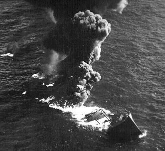
Empire Gem
Fast Facts: Features: Need Gear? Download all Cape Hatteras GPS Coordinates The British tanker, Empire Gem, was en route from Texas to the United Kingdom with a full cargo of more than 10,000 gallons of gasoline when she was sunk in 1942 by a German U-boat. The Gem was approximately 15 miles southeast of the…