Author: DiveSpots
-

San Remo
Fast Facts: Features: Need Gear? Download all Boca Raton GPS Coordinates This section of the third reef line can be found about three miles north of the Boca Raton Inlet. This site ranges in depth from 45 to 65 feet and has several caves and overhangs which protect the variety of pelagic life which inhabits…
-
Opal Towers
Fast Facts: Features: Need Gear? Download all Boca Raton GPS Coordinates The reef ledge approximately 2.5 miles north of the Hillsboro Inlet is known as Opal Towers. The area has a ledge which reaches as deep as 42 feet with a maximum 10 foot profile. Sponges, corals, lobster, eels, turtles, octopuses, parrotfish, angelfish, and many…
-
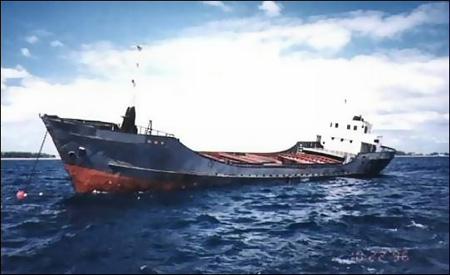
Noula Express
Fast Facts: Features: Need Gear? Download all Boca Raton GPS Coordinates This 114-foot steel-hulled freighter is located a little over one mile south-southeast of the Boca Raton Inlet. She was the first freighter to be sunk in this area. In her early years, after her sinking in 1988, this ship was very popular, especially for…
-
Labonte Reef
Fast Facts: Features: Need Gear? Download all Boca Raton GPS Coordinates Labonte Reef is located slightly over one mile north of the Hillsboro Inlet, offshore from the Hillsboro Landmark Condominium. This is a great beginner’s reef with a depth range of 35 to 45 feet at the sandy bottom. There are some great holes and…
-
Jap Rock
Fast Facts: Features: Need Gear? Download all Boca Raton GPS Coordinates Jap Rock is a beach dive at the north end of Boca Raton’s Spanish River Beach. The rocks are easy to spot breaking through the surface, forming a little “bay”. This site is a nice spot for snorkelers because of its shallow depth and…
-
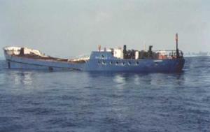
Captain Tony – M/V Becks
Fast Facts: Features: Need Gear? Download all Boca Raton GPS Coordinates The Captain Tony, 167-foot long Dutch freighter originally named the M/V Becks, was scuttled on October 22, 1996 in 85 fsw of water off the coast of Palm Beach / Boca Raton. The Captain Tony, so named in memory of Captain Tony Townsend, a…
-
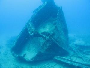
Budweiser Bar
Fast Facts: Features: Need Gear? Download all Boca Raton GPS Coordinates This 167 foot long coastal freighter was built in 1965 and was used to transport dry goods to the Bahamas and Haiti. In July of 1987, she was sunk in 95 feet of water where she sits today, upright with her bow to the…
-
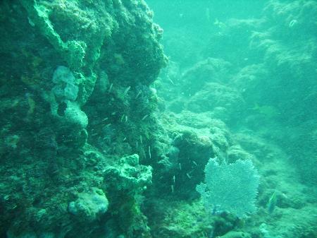
Boca Artificial Reef Ledge
Fast Facts: Features: Need Gear? Download all Boca Raton GPS Coordinates Although currents can be strong and dangerous, this is a great divespot filled beautiful sea life. The natural rock ledge is covered in soft coral, sponges and algae. The ledge is between 10 and 15 feet high and extends for over 1000 feet North…
-
Berry Patch
Fast Facts: Features: Need Gear? Download all Boca Raton GPS Coordinates The Berry Patch, a 65-foot steel tug that was sunk in 1987, was once known as the A.L. Spenser. The ship lies between the Hillsboro Inlet and the Pompano Pier about a mile offshore. It is about 150 feet south of the Ancient Mariner,…
-
Ancient Mariner
Fast Facts: Features: Need Gear? Download all Boca Raton GPS Coordinates This Coast Guard cutter was built in the 1930s and was originally known as the Nemesis, after the Greek goddess of vengeance. During WWII, she was used as a sub-chaser and a convoy escort. She was decommissioned in 1964 and sold to several firms…