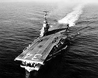
After nearly two years of delays caused by hurricanes and permitting issues, the USS Oriskany was successfully sunk on May 17, 2006, to become the world’s largest intentionally created artificial reef. Hundreds of boats passed by the “Mighty O” after she was towed to the deployment site about 22 miles offshore of Pensacola. The U.S. Navy used more than 500 pounds of plastic explosives in controlled charges to blow holes into the 888-foot aircraft carrier. Boaters watching from a mile away saw the flashes of explosives and smoke before the stern went under. The bow lifted into the air, the rusty flight deck slipped under the water and the Oriskany was sunk in just 37 minutes.
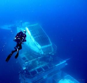
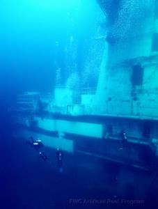
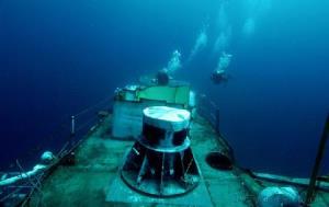
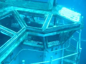
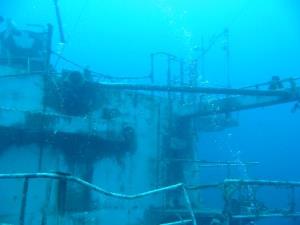
The massive aircraft carrier rests in 212 feet of water in a north-south orientation on the sandy bottom. The flight deck is at 130 feet (original reports claimed it was 150 feet — a bit too deep for recreational divers). With an overall height of 151 feet, there is plenty of ship to view within recreational dive limits. The “island” where the bridge and flight deck control are located along with eight decks rises above the flight deck. Divers checking the site the day after Oriskany’s sinking reported seeing the tower from the surface and underwater visibility of 100 feet.
The USS Oriskany was launched in late 1945 and served admirably in both the Korean War and in Vietnam. The carrier housed a crew of nearly 3500 and 80 aircraft. The Oriskany was one of the ships used as a show of force by President Kennedy during the 1962 Cuban Missile Crisis and was the carrier from which Senator John McCain launched his plane before being shot down over Vietnam.
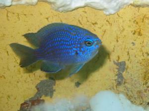
The Oriskany is the first warship to be sunk under a pilot program to deploy old naval ships as artificial reefs. The cost of the project was $20 million. It is hoped that this “Great Carrier Reef” will boost tourism to the Pensacola region as well as serve as a habitat for the growth of marine life.
NOTE: The GPS coordinates provided are for the uppermost structure.

| Waypoint: ORISKN | Latitude | Longitude |
|---|---|---|
| Degrees | 30.0425 | -87.0063833333333 |
| Degrees/Minutes | N 30 2.550 | W 87 0.383 |
| Degrees/Minutes/Seconds | N 30 2 33.000 | W 87 0 22.980 |


Leave a Reply